
Scenic Drives

Scenic Byway 143
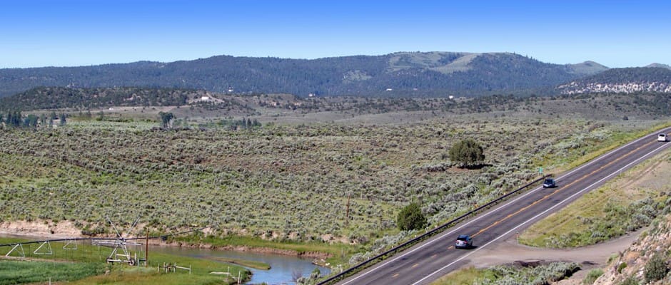
The great Scenic Byway 143 is one of the nation’s most historic and breathtaking stretches of road providing access to several of Utah’s most beautiful and admired state and national parks. Travelers can drive from one end of the Great Basin in western Utah all the way to Heritage Highway 89 by way of Scenic Byway 143 and in so doing, experience a path made known by historic pioneer treks and Native American travelers alike.
A Road Paved In History
The name, “The Patchwork Parkway” is also used when referring to Scenic Byway 143 and tells the story of early Mormon pioneers who were settlers of the town of Panguitch, who in suffering long journeys in the dead of winter in search of food relied on the saving grace of many handmade quilts laid gently over the snow one at a time to help them cross the treacherously frigid trail.
Before the trail was made famous by pioneer treks, this route was frequented by the Paiute people who scoured the plateaus for hunting and gathering purposes for hundreds of years. Rock art depicting their travels can be seen at various historical stops along the way.
Scenic Views And Recreational Activities Abound
Modern day travelers can enjoy a stretch of road that passes through thousands of years old lava flow remnants and the famous Panguitch Lake, just 18 miles outside the town of Panguitch (Panguitch is the Paiute word meaning “Big Fish”), where the most avid of anglers enjoy themselves for hours at a time. Scenic Byway 143 boasts a top elevation of over 10,000 feet and provides miles of exquisite views of mountainous landscapes and scenic desert plains.
Any stop along Scenic Byway 143 is sure to provide amazing views; be it miles of fields filled with wildflowers in the spring and summer, pristine snow topped aspens during the winter months, lakes surrounded by mountains, or the majestic sight of the “Grand Staircase” plateau breaks which extend for miles on end. The fall months provide endless miles of beautiful crimsons and reds due to the various oak and maple trees. The best time for viewing fall foliage along Scenic Byway 143 is between mid-September to mid-October and has been named a top national spot for appreciating autumn hues.
True outdoor enthusiasts and those who appreciate the natural beauty that Utah has to offer will surely enjoy the many national parks, recreational adventures, charming towns, hunting opportunities and historic stops that are accessible through travel along Scenic Byway 143 and in the town of Panguitch. Various trails providing horseback riding, ATV rentals and mountain biking can be found within the Panguitch city limits and beyond.
Famous National Parks Outside Of Panguitch
One of the most pleasant stops along the byway is the city of Panguitch itself, which provides many accommodations for travelers, and easy and timely access to some of Utah’s most notable and well known national parks. Panguitch Lake, famous for its fishing, lures many with its reputation of the promise of a good catch, paired with picturesque scenery and is located just a little outside of town. Panguitch Lake is one of Utah’s most popular fishing spots. Brian Head, which is the highest elevation community in Utah at 10,000 feet, provides a host of recreational adventures including a well renowned ski resort and is accessible by driving a short ways from Panguitch. With a convenient location in the center of some of the nation’s most well known parks, Panguitch is the perfect place to stay for those wanting to visit places such as Brian Head, Bryce Canyon, the north rim of the Grand Canyon, Dixie National Forest and Lake Powell to name a few. Brian Head Peak and Bryce Canyon National Park are accessible from Scenic Byway 143 just outside of Panguitch and are among Utah’s most famous landmarks and tourist attractions due to amazing rock formation views stretching a hundred miles in every direction, amazing wildflower displays, and ample wildlife and recreational attractions.
SCENIC BYWAY 12
Travel Along the Scenic Byway
Just seven miles south of the city of Panguitch and passing along the sweeping landscape of Southern Utah’s ancient past spans a 124 mile road known as “the Scenic Byway 12.” Byway 12 is a true gateway to desert paradise. Travelers wishing to embark on a journey through breathtaking landscapes, prehistoric sea beds, rustic sagebrush wilderness, and one of the world’s highest and most remote alpine forests can drive, bike, hike, ski, swim, and fish throughout this historic corner of the country.
Passing through Garfield and Wayne Counties, Byway 12 boasts some of southern Utah’s most prized national treasures: Bryce Canyon, Capitol Reef, Kodachrome Basin, Escalante Petrified Forest, the Anasazi Museum, Glen Canyon National Recreation Area, Grand Staircase-Escalante National Monument, and Dixie National Forest, a 1.8 million acre parcel of wilderness.
Visitors can access scenic Byway 12 from two entry points. From Highway 24, the northeastern gateway is in the town of Torrey near Capitol Reef National Park. Traveling from US 89, the southwestern gateway is located just seven miles south of the city of Panguitch.
Passing through both private and public wilderness, travelers enjoying the magic of Scenic Byway 12 encounter stunning views, the staggering cliffs of Powell Point, otherworldly rock formations of the Blues, as well as ancient Anasazi granaries (stone and mud structures ).
The rolling slick rock of Byway 12 is another adventurous draw for travelers, along with the promise of wild and untamed wilderness: buttes and mesas, snaking canyons, and the luster of rock walls soiled with the archaic minerals of ancient earth formation. A glimpse of the wildlife is a much sought-after pleasure for sightseers: hawks, eagles, and vultures can be spotted, as well as deer, elk, and even the mischievous coyote infamously elusive in Native American tales.
Violent storms create turbulent, purple hues in this famously animated sky covering Byway 12. Its unusual southwestern beauty is infused with the wild aroma of pinyon, sagebrush and aspens, while the curious rock towers and ancient ruins evoke the spirit of the mythically aged sages of Native shamanism. Around every bend and every turn lies a haunting visual experience for the senses.
Most of the land around the byway is publically owned and managed by different federal and state agencies, including the Bureau of Land Management, U.S. Forest Service, National Park Service, and Utah State Parks. Protecting the land and preserving the beauty of these national treasures is the goal each of these agencies hold in common. For the great West is truly a gem of the new world.
Red Canyon

Ponderosa pines surround the red sandstone hoodoos populating Red Canyon in abundance. At 7,400 feet elevation, this miniature Bryce Canyon is a prime area for cross country skiing, sledding, horseback riding, ATV off-road adventures, mountain biking, and cool summer hikes. Part of the Dixie National Forest, Red Canyon winds along nearly four miles of Scenic Byway 12 and is located just twelve miles outside of Bryce Canyon National Park.
The landscape’s famous hoodoos (also called tent rocks, fairy chimneys, and earth pyramids – or as the French call them, “ladies with hairdos”) can be explored by many different trails throughout the canyon’s winding, desert roads. Sculpted from Claron limestone from ages of water and wind erosion, the abundance of hoodoos in Southern Utah are a popular attraction for tourists around the world.
The five mile, paved bike trail that runs through Red Canyon takes visitors on a scenic route through ponderosa pine forests to the great Paunsagunt Plateau, with access to the Grand View Trail, and the famous Thunder Mountain Trail.
Visitor Center
Open from Memorial Day to Labor Day, visitors can begin their journey into the iconic desert at the Red Canyon Visitor Center. Managed by the U.S. Forest Service, the center provides detailed information on local trails, premium sightseeing areas, and the best spots for camping. Located just four miles from the intersection of Scenic Byway 12 and Highway 89, the Visitor Center also provides tourists a picturesque spot of picnicking, as well as bathroom access, drinking water, and a campground for those who wish to rough-it in closer vicinity to accessible Forest Rangers.
Camping
For just $11 a day, sightseers can camp among Red Canyon’s famous ponderosa pines, junipers, and Douglas firs. The campsite opens on May 1st and is available to tourists usually until October 1st. Providing 35 acres of campsite, tables, flushable toilets, showers, group sites and even some RV pull throughs, the campsite at Red Canyon is ideal for travelers wishing to explore the arid desertscape in a more intimate setting.
Red Canyon History
Red Canyon is certainly not as famous as the area’s Wild West legends, like Butch Cassidy, but his infamous crimes are well known throughout the area, and his childhood home was a cabin nearby, in Circleville. Western lore tells of a time when old Butch got into a scuffle at a town dance in Panguitch over a girl. Believing he killed the man from a hard blow, Cassidy fled to the craggy sweep of desert, today known as Red Canyon. The man he hit lived, but a dangerous gang of handlers were dispatched to find him. Butch managed to elude the posse by hiding out along the rugged road that is now famously known as the Cassidy Trail. The story has left Red Canyon with a shadow of the infamous western outlaw, and the area’s locals aren’t quick to forget it.
Losee Canyon Trail
Connected to the infamous Cassidy Trailhead and located east of Red canyon Visitor Center on Highway 12, the Losee Canyon trail begins at the bottom of Losee Canyon and takes visitors on a scenic trip along the canyon floor. Hikers can wind their way through the dramatic red hoodoos and the multi-colored sandstone cliffs that lead into the higher elevations of Red Canyon.
Casto Canyon Trail
Amid the tantalizing scents of pine and cedar lies the spires of orange rock that rise above the southwestern canyon walls. The lower area of Casto Canyon is bursting with Douglas firs, long-leaf pine, and sprinklings of sage brush and wildflowers. In May the trail’s winter snow has all but melted, and visitors can enjoy hiking and ATV riding. Most of the trail is single-track, and it offers many twists and turns through the arid rock formations. Casto Canyon trail is a beautiful and up-close exploration of Utah’s canyon lands.
Panguitch Lake

You’ll enjoy spending the night in Panguitch with the intention of rising early for a quality fishing experience at Panguitch Lake, or catching photographs of the sun rising over the mountains and canyons. Panguitch Lake is a mere half an hour drive from Panguitch itself and is also within close proximity to many rivers and streams. Some of the biggest trout in all of Utah call Panguitch Lake their home which makes it a popular spot both in summer months as well as for ice fishing during the winter. The fishing remains the most popular reason for the visit drawing in enthusiastic fishermen in boats, floater tubes, or along the shore in the warmer months or eagerly huddled around holes in the lake during the winter.
There are plenty of boats available to rent for the day and lots of other activities for every family member to enjoy while visiting the lake. ATV rentals are also available as are horseback riding trips, and trails for mountain biking.
Panguitch Lake is surrounded by a lush forest which extends down to the shoreline of the lake. There are many biking and hiking trails all around Panguitch Lake in which travelers are likely to come across a variety of wildlife including coyotes, elk, hawks, eagles, foxes and various types of deer.
Even for those who aren’t big on fishing, the scenic lake is a place of complete relaxation and picturesque loveliness where sitting by the shore on a blanket with loved ones makes for a very peaceful day.
Kodachrome Basin

About
Only an hour’s drive from Panguitch, Kodachrome Basin State Park brims with 67 towering sedimentary chimney rocks. Ranging from six feet to 170 feet, these multi-hued sandstone layers expose over 180 million years of geological time. Upon discovering the staggering depth of color and beauty in this park, a 1948 National Geographic Society Expedition named the area “Kodachrome,” after the famous Kodak color film.
Believed to have been pieces of solidified sediment filling the ancient geysers that once presided over the landscape, researchers speculate the area once closely resembled the geological formations of Yellowstone National Park. Overtime, however, the Entrada sandstone eroded, exposing the staggering array of chromatism displayed on the sandstone surface. The colors are remarkable: red, white, brown and yellow layers of sediment shift and transform with the movement the sun, the shadows of valley, the brilliance of the night stars.
Biology
A unique array of hardy trees, flowering plants, grasses and shrubary thrive in the hash semi-arid climate of this Southern Utah wilderness. Visitors surveying the landscape will glimpse the fauna and flora of the Wild West, including Utah juniper, big sage, Mormon tea (ephedra), Indian Paintbrush, evening primrose, yellow flax, locoweed, thread grass, locoweed, and pinion pines.
Wildlife still roams the area’s abandoned canyon lands: Mule deer, mountain lions, coyotes, bobcats, and gray fox hunt jack rabbits and rock squirrel in the shadows of valley’s hovering sandstone towers, while rattlesnakes, mice, and lizards lurk beneath rocks and make their homes under the dessert’s arid surface. Ravens and golden eagles are native to the primitive lands, while rock wren, pinion and scrub jays, chukar partridge, and chipping sparrow patrol the endless silence of the canyon’s skies.
Recreation
Kodachrome Basin State Park is a photographer’s paradise: A visual feast of stunning vistas, majestic wildlife, silhouette of chimney rocks, and endless scope of cloudless skies makes for a compelling contrast of textures and colors. Other adventurists may want to simply take advantage of the area’s hiking trails unfettered by a camera lens.
Under a canopy of darkness, the sky above Kodachrome Basin transforms into a symphony of endless stars. Lack of light and pollution makes the area one of the most popular stargazing locations in the west.
Horseback trails are also available throughout the rugged wilderness.
Kodachrome Basin State Park is open year-round and has a $6 entrance fee.
Escalante Petrified Forest State Park
Just a short distance from Kodachrome Basin on the scenic Byway 12 route, Escalante Petrified Forest State Park is popular destination for many water sports, including fishing, boating, and swimming. The area also includes The Petrified Forest Trail, a one-mile loop through lava flows and a vast variety of petrified wood. For a more strenuous hike, visit the park’s Sleeping Rainbows trail – a steep, .75 mile trail covering the areas boulders and rocks
In 1991 the forest opened a visitor’s center, showcasing marine and plant fossils, petrified wood, and fossilized dinosaur bones dating over 100 million years old.
Highway 89
When you visit Panguitch, you’ll enjoy one of the great scenic drives that passes through Panguitch, Highway 89. This scenic highway stretches north and south from Panguitch. Going south you’ll drive east from the middle of town, and then follow Highway 89 as it bends south. The southern section of Highway 89 will take you past the turn-off to Scenic Byway 12, and continues south past Scenic Byway 14, Scenic Byway 9 (to Zion National Park) and further south to Kanab, and the Grand Canyon North Rim.
Going north Highway 89 takes you toward the communities of Circleville, Marysvale, and Richfield and continues north connecting to areas in northern Utah and beyond the Utah state border into Idaho.
Grand Staircase-Escalante National Monument

GSENM Road Report as of February 2, 2021. (pdf file)
Check with your friendly neighborhood visitor center for the most current conditions.
About
A vast connection between some of Southern Utah’s most famous canyon landmarks, the Grand Staircase-Escalante National Monument stretches across 1.7 million acres of the ancient and prehistoric west. A vast sequence of sedimentary rock layers reaching from Bryce Canyon National Park through Zion National Park and into the Grand Canyon, this immense stretch of land dominates the lonely wilderness of Utah’s rural south. Relatively new on the world scene of ancient discoveries, this oasis of historical treasures brims with geological, biological, paleontological, and archeological wonders. The landscape is primitive, decorated with wandering desert streams, slot canyons, and monoliths. The pristine Grand Staircase preserves a prehistoric past, full of original flora, fauna, species of dinosaurs newly discovered, and ancient Anasazi artifacts.
Prehistoric History
Paleontologists and archeologist have been calling southern Utah a “climatological sweet spot” for years. The strong and wet storms in Southern Utah cause “episodic rapid erosion” which expose fossils, while the scarce appearance of rain protects the remains from destroying the deep rooted plant life. These factors create the perfect conditions for exposing fossil remnants for collection and observation on the canyon’s surface. Fossil records around the Grand Staircase date back to nearly 70 million years ago. Large dinosaur skeletons were excavated in the 1880s in northern regions of the Grand Staircase, and in the late 20th and 21st centuries a new collection of fossils emerged on unexplored strata, and researches predict a high probability of the further discovery of new species in the near future.
Recreation
Just a daytrip from Panguitch, this rugged landscape calls visitors on a variety of Wild West adventures: From horse back riding through the canyon’s lonely Anasazi wilderness, or rock climbing on the historic rocks themselves, the Grand Staircase Monument is a true traveler’s treasure.
Horseback Riding
Backcountry of the Grand Staircase is rugged and primitive. Not many travelers venture out in the canyon’s remote wilderness, adding to the areas pristine feeling of emptiness and wonder. Under a canopy of unending sky, travelers rough the terrain by horseback to partake of the breathtaking scenery and experience the canyon’s isolated whispers, lonely shadows, and ancient spirits.
Rock Climbing and Canyoneering
This wild and unfettered wilderness is primitive indeed, and travelers looking for an epic experience with the rocks may climb their towering remains. Subject to zone and other management restrictions, rock climbing in the Grand Staircase is open in areas like Hell’s Backbone, Sulphur Creek, Devil’s Garden, Spooky Gulch, and Death Hollow. Visitors need only read the inhospitable names of these vast canyons to understand why early white settlers associated the area with doom. Rock climbing and canyoneering in this rugged land is sure to give adventurers the thrill of a lifetime. Seeking a less risky adventure? The Grand Staircase Monument hosts plenty of back-country hiking trails perfect for a day trips, mountain biking, and scenic highway trips for those wishing to experience the canyon’s rocky wonders from the comfort of their vehicle.
More images
Dixie National Forest

Just outside of the historic town of Panguitch, Utah lays the Dixie National Forest which encompasses over 170 miles and roughly 2 million acres of Southern Utah’s beautiful landscape. As the very largest national forest in all of Utah, the scenery ranges between four different geographic areas providing every desirable view from colored cliffs to lush green forests, as well as vast climate changes including snowy fields, lush rainfall, and wildflower filled fields. Temperatures range drastically depending on the time of year and may reach highs of over 100 degrees Fahrenheit and lows dropping to below zero.
While staying in Panguitch, a town rich in pioneer and Native American history, one day-trip into a section of the Dixie National Forest is a beautiful drive along Scenic Byway 143. The drive itself is spectacular and provides countless photo opportunities regardless of the time of year. The forest is covered in high desert plants at lower elevations and great pine, spruce, fir and aspen trees in the upper reaches.
The Dixie National Forest is broken up into four large sections, each of which include a major plateau and significant elevations which range anywhere from 6,000 to over 11,000 feet. The highest of these plateaus is the Aquarius Plateau which is actually a part of the even larger Colorado Plateau.
Recreational Opportunities

The Dixie National Forest has many recreational activities available with options for diverse tastes and skill levels. Families, couples, and individuals can enjoy hunting, breathtaking scenery, fishing, horseback riding and photography. For those who want to enjoy more athletic endeavors there are winter sports such as skiing and snowboarding adventures to be had, and snowmobiles to rent. For summer months you’ll find, ATV rentals, horseback riding, mountain biking, hiking, canoeing, swimming, and fishing.
Nature enthusiasts and photographers will find plenty to see with over 83,000 acres of wilderness available and hiking trails for beginners to more advanced. Wildlife is abundant for those who wish to catch a glimpse or snap a picture of elk, deer, eagles, hawks, and more.
In fall season, hunters will find elk and mule deer available, while year-round photographers enjoy the quest of spotting these wild animals in their natural habitat.
Various fishing opportunities exist in the way of streams, lakes, and reservoirs, with brown, rainbow, cutthroat and brook trout in large numbers.
Many people enjoy lunch at a forest picnic site before heading back to Panguitch for comfortable accommodations, and a variety of restaurants and shops.
Cedar Breaks

Cedar Breaks National Monument: Panguitch city is situated in an expansive stretch of seemingly endless outdoor beauty which has helped Utah earn a reputation as a state rich in natural resources and abundant scenery. One of the most accessible and popular places to visit after a restful night’s sleep in Panguitch is Cedar Breaks National Monument. Those who are familiar with Bryce Canyon will find many similarities in visiting Cedar Breaks with its stunning array of colors in yellow, purple and red. The brilliant colors have earned Cedar Breaks the name of the “Circle of Painted Cliffs” by the Indians who have resided in the region. The breathtaking Cedar Breaks formations are shaped similar to an enormous coliseum which reaches over 2,000 feet from top to bottom and was formed through the strong forces of erosion. By traveling down into the canyons of the Cedar Breaks, one can find meadows of aspens, ponderosa pine trees, and even Bristlecone pine trees, one of the world’s oldest species of tree. Wildflowers bloom in abundance during the summer months and create quite a spectacle.
Many of those who stay in Panguitch do so because of the many recreational outdoor activities that are nearby. Visitors to Panguitch can easily reach Cedar Breaks National Monument and enjoy a wide variety of outdoor adventures such as photography, sightseeing, picnicking in some of the most beautiful scenery in the entire nation, hiking miles of memorable trails, bird watching, and nature study. During the winter months there are multiple resources for snowmobiling and skiing on the mountains and at the Brian Head Resort which is a mere three miles distance from Cedar Breaks. Summer months in Cedar Breaks provide a mild and pleasant atmosphere with temperatures ranging in the mid sixties to low seventies; a perfect climate for enjoying long walks while observing miles of splendor. After spending an exciting day at Cedar Breaks National Monument and a pleasant evening in Panguitch, Utah enjoying dinner at local dining establishments.
Bryce Canyon

Bryce Canyon History
Little is known about the life and history of the Native tribes who walked among the lonely shadows of Bryce Canyon’s hoodoos. Natives populating the area primarily hunted throughout the range while living under the stars in the river valleys below, seasonally harvesting the forest resources and wild game in the plateau. Ancient artifacts suggest the Ancestral Puebloan (Anasazi) lived in the Bryce Canyon vicinity over 2000 years ago.
The Fremont Natives were next to inhabit the Bryce Canyon area, staying until the early 1200s. The Paiute tribe left the most recent native imprint on the canyon’s energy. It was these natives that orally passed down the ancient names of many surrounding rock structures to John Wesley Powell , a United States Army major who led a scientific expedition to the area in 1872. But it was the Mormon pioneers that settled near Bryce Canyon, and the group for whom Bryce Canyon takes its name.
Ebenezer Bryce homesteaded Bryce Canyon in the mid 1870s. Bryce and his family landed in the Paria Valley with his in 1875, sent by the Mormon Church as a skilled carpenter and useful assent for the newly settling town. Building a road to the top of the plateau, Bryce made it possible for the townspeople to gather firewood and timber, and also built an irrigation canal so the pioneers could raise crops and animals. Bryce and his family later founded the town of Bryce in the Gila River Valley in Arizona.
Bryce Canyon was officially declared a National Monument in 1924. After the declaration of the new national monument, interest in the Bryce Canyon area began to grow. In an attempt to upgrade the area, the Union Pacific set out to make improvements in the transportation to Cedar City by creating a shuttle service to the National Monument from the area’s train depot.
In an effort to help safeguard the area, congress passed a bill in 1928 to increased the amount of protected land and to double what was already protected by the new national park. Along with the expansion of land, the name of the park was officially changed to Bryce Canyon National Park on February 25th, 1928.
Today the national monument still maintains the charm of its 1930s beginnings, while attracting thousands of visitors each year. It’s a true Utah landmark.
About
Named after Ebenezer Bryce, the man who homesteaded the area in 1874, Bryce Canyon National Park is a stunning congregation of large natural amphitheaters. Hardly a “canyon,” these unique and distinctive geological structures are called hoodoos, formed by the frost weathering and stream erosion of lake bed and river sedimentary rocks. Boasting a complexion of hues marbled in wave-like formations of red, orange, and white, these ancient rock formations provide a vibrant, poetic tapestry of color for park visitors.
The Canyon’s famously extraordinary geology is carved from the eastern edge of the Paunsaugunt Plateau in horseshoes-shaped patterns, providing primitive back-country for the adventurous travelers who wish to take a journey into Utah’s forgotten past.
These vast canyon lands have seen several formations throughout the eons of the planet’s formation, but most have been eroded away as a result of two major uplifts. Some scientists estimate that around 70 million years ago an uplift called the Laramide orogeny started to rise, affecting the entire western part of what would become North America. This geological shift of the earth’s surface closed the Cretaceous Seaway and helped create the West’s famous Rocky Mountains.
Some of the formations decorating Bryce Canyon’s immense and lonely landscape are part of the Grand Staircase. This super-sequence of rock spreads its magic as far as the Grand Canyon and Zion’s National Park.
What to do
Bryce Canyon offers a multitude of extraordinary experiences for the adventurous travelers. Photographers will find an endless canyon sea of photogenic vistas, breathtaking sunsets, majestic sunrises, and one of the most profound night skies in North America.
Back country hiking provides more than your average day hike: overnight hikers explore the park’s two designated trails, Riggs Spring Loop and Under-the-Rim. Under a vast magnitude of night sky explorers witness one of the darkest nights to be experienced in the New World. Stargazers feast their eyes upon more than 7,500 stars – luminous enough to read by. Park rangers take full advantage of this other-worldly sight by hosting stargazing events and night programs on astronomy, nocturnal animals, and night sky protection. The canyon also presents an Astronomy Festival in the summer months, attracting thousands of visitors from all over the world.
For sightseers looking for a simpler approach to the canyon’s wonders, Bryce hosts a breathtaking scenic drive throughout the canyon’s ghostly formations, providing access to 13 viewpoints over the amphitheaters. The rugged area also boasts several marked and maintained trails for day hikes where visitors can tread upon the paths ancient ancestors once blazed. These light trails can easily be hiked in less than a day (round trip), while the canyons more strenuous hikes intersect, amping up the challenge for hikers desiring a more physically rewarding experience.
Bryce Canyon Trails
Moderate to Easy:
Mossy Cave (northwest of Tropic, one hour, State Route 12)
Rim Trail (5–6 hours, anywhere on rim)
Bristlecone Loop (one hour, Rainbow Point)
Queens Garden (1–2 hours, Sunrise Point)
Moderate Trails
Navajo Trail (1-2 hours, Sunset Point)
Tower Bridge (2-3 hours, north of Sunrise Point)
Strenuous Trails
Fairyland Loop (4-5 hours, Fairyland Point)
Peekaboo Loop (3-4 hours, Bryce Point)
Visitors can also explore the vast hoodoos by horseback (April – October) and winter time ski trails invite travelers to adventure through the canyon’s wonders by snow-shoe.
